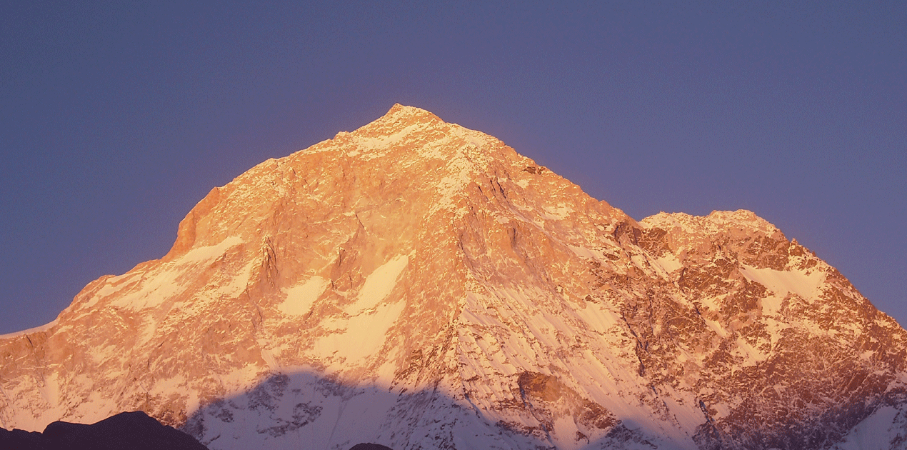
Makalu Expedition 8,463m
Every interested people in mountaineering are well-known that Mt. Makalu (8463m) is the fifth highest mountain Peak on the Earth. Mt. Makalu is Situated in the heart of eastern Himalayas albeit just about 14 miles east of Mt. Everest. The Massive Mountain with a prominence of 2386m and taking into account surrounding deep valleys like Arun and Barun is somewhat isolated.
The valleys, in particularly the Barun valley, are the home of pristine forests and alpine meadows of Nepal. Within this wide range of altitudes and climates, the Makalu-Barun area contains some of the richest and most diverse flora and fauna of Nepal. Diverse ethnic communities of Rai, Sherpa, and Shingsawa (Bhotia) have inhibited the lower parts of these valleys. Due to isolation these communities are economically poor however they represent rich cultural heritage untouched by technology and world cultural influences. They are the custodians of Makalu- Barun unique biological and cultural treasures. Due to its relative inaccessibility, the area is little known to majority of the visitors, however, those who have visited, return home with unforgettable memories of the area and its people.
Mt. Makalu Expedition:
Mt. Makalu was first climbed by a French team in 1955. This peak was first mapped and taken photograph of it from the Tibetan side by the British Everest reconnaissance in 1921. Hillary and Shipton had taken that photograph of Mt. Makalu on their Everest reconnaissance in 1951. The first attempt on Mt. Makalu was in 1954 by a US team from California, who trekked all the way from the Indian border near Biratnagar. At the same time a British team had reached in the summit, but this Makalu Expedition was abandoned when Hillary became seriously ill and had to be
evacuated. In the autumn of 1954 a French team attempted the peak. In the following spring, successfully ascents were made by three teams of French climbers on successive days. The Japanese also climbed Mt. Makalu in 1970, another French team climbed it in 1971 and a Yugoslav expedition reached the summit in 1975. Mt. Makalu Expedition in Nepal is very adventurous route to climb because on its west face. This Mt. Makalu is a
little bit dangerous as well. The 5 attempts were made before climbing this Mt. Makalu then only it was succeeded in the final. The West Face of Mt. Makalu was successfully scaled in 1997. The Russian expedition had taken the route of this West Face led by Sergey Efimov and climbed the top on 21st of May 1997 via the most difficult route.
ITINERARY
Day 01 : Arrival in Kathmandu. Transfer to your hotel for
refreshment.
Day 02 : Sightseeing around world heritage sites
Day 03 : Issue climbing permits
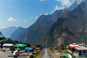
Day 04 : Fly to Tumlingtar (285m-938ft) and arrange for orters.
Day 05 : Trek to Mane Bhanjyang.(1440m-4724ft)
Day 06 : Trek to Chichira. (1980m-6496ft)
Day 07 : Trek to Num (1851m-6072ft)
Day 08 : Trek to Sheduwa (1500m-4922ft).
Day 09 : Trek to Tashigaon. (2100m-6890ft)
Day 10 : Trek to Kauma. (3760m-12337ft)
Day 11 : Trek to Dobato. (3700m-12140ft)
Day 12 : Trek to Jark Kharka (4800m-15749ft)
Day 13 : Trek to Hillary Base Camp (4800m-15749ft)
Day 14 : Trek to Makalu Base Camp. (4870m-15978ft)
Day 15-48 : This is Climbing period Mt. Makalu.
Day 49 : We need to Clean up Base Camp
Day 50 : Trek back to Yak Kharka.
Day 51 : Trek to Mumbuk.
Day 52 : Trek to Tashi Gaon.
Day 53 : Trek to Num
Day 54 : Trek to Chichira.
Day 55 : Trek to Tumlingtar.
Day 56 : Fly to Kathmandu. Transfer to your hotel.
Day 57 : Rest day in Kathmandu
Day 58 : Transfer to airport for departure.
Please contact us by email or call us for Expedition cost:
Makalu Expedition Full Board Services:
We provide personal tent and food, which will be prepared by their climbing Sherpa. Hand held radios on the mountain to maintain communications between ABC and high camps.
We provide a personal climbing Sherpa guide to help the clients to reach the summit. Personal climbing Sherpa will set up camp 1 and camp 2 and camp 3 including food provisions, fuel and oxygen and will guide and assist the client on the summit day.
Approaches to ABC:
The trek into the base camp of Makalu is absolutely breathtaking and takes you back in time when all Himalayan mountains were approached on foot.
The trek starts at low elevation of 920m in Tumlingtar, where we arrive on a flight, and rises gradually over next 10 trekking days. It is a perfect way to acclimatize before base camp is reached and to take on climbing relatively
quickly. From the village of Tumlingtar situated in the low country the trek climbs through narrow gorges of Arun Valley, rhododendron forest and local pastures to emerge into the higher alpine country. We pass from subtropical to high alpine vegetation with incredible diversity of flora and fauna and untouched and diverse cultures.
Climbing Routes:
Makalu has many interesting routes leading to the summit via west ridge, west face, south face, southwest face and northwest buttress. The normal commercial route is past the Southeast Peak and along the Southeast ridge. The climb is straightforward but moderately technical with exposure on the SE Ridge; it requires some fixed rope set-up.
Traditionally there are 3 camps, high camp C1 (6,500m), C2 (7,300m) at the bottom of the Southeast Peak ridge and C3 (7,900 m) at the beginning of the SE ridge. With very low Base Camp the ABC is set-up at 5500m. The terrain encountered on the ascents varies from glacier crossings to steep snow fields and requires a good understanding of basic alpine climbing techniques. Makalu has been climbed Alpine style but traditionally all commercial operators practice expedition style to improve the chances of summit success for the clients.
The bottom part starts from the base of the West Face at 5,800 meters and climbs to the hanging ice-fall at 6,100 meters to the right part of the ice-fall. The second part extends from the plateau above the ice-fall along 35 to 45
degree elevation’s rock up to the 6,500 meters high. The next section is an ice-rock wall, 50 to 55 degrees steep & that extends to 7,400 meters height. The last final section begins 70 to 75 degree elevation’s rock pillar, which leads to the west ridge at 8,000 meters height till to the top of the summit.
Ropes are typically fixed from 5800m to 6100m and from 6500 m to 7500m. Camps established by the Russian Team were at the following locations. The French Route on the West Pillar is an aesthetically stunning line that has been seldom attempted. It is an exceedingly difficult, a very steep pillar that was first successfully ascended in 1971.
The crux of the line comes at approximately 7,600m in the area of the Seignior Wall.
The package includes:
Climbing permit fee Accommodation in Kathmandu at a tourist class hotel on bed & breakfast plan as per itinerary.
Transportation of all foods and Camping equipment’s to base camp and back. Full board during the trekking, Breakfast, Lunch, Dinner.
All kitchen equipment’s; kitchen tent, dining tent, toilet tent, chairs and tables at the base camp climbing ropes, Guide and Climbing Sherpa
Cook and kitchen boys at the base camp.
Local transport in Kathmandu (Hotel-Airport-Hotel)
The package excludes:
Airfare from / to your country.
Nepal entry visa fee. (can be obtained at the airport upon arrival
Lunch and dinner in Kathmandu
High altitude food and fuel above base camp
Personal climbing gear and equipment above base camp.
Personal insurance such as travel, accident, medical and emergency evacuation.
Nepal custom duty for import of expedition goods arriving to Nepal by air or road.
Expenses of personal nature such as drinks, laundry, postage, telephone, etc.
Climbing oxygen.
Tips and bonuses for climbing Sherpa and other staffs.